When going through our portfolio and site photos it is nice to do a comparison to see how accurate our visualizations and graphics are to the now completed project.
Can you tell which the real photo and which is the 3D visualisation in the following series of images ?
Kingfisher Burrow
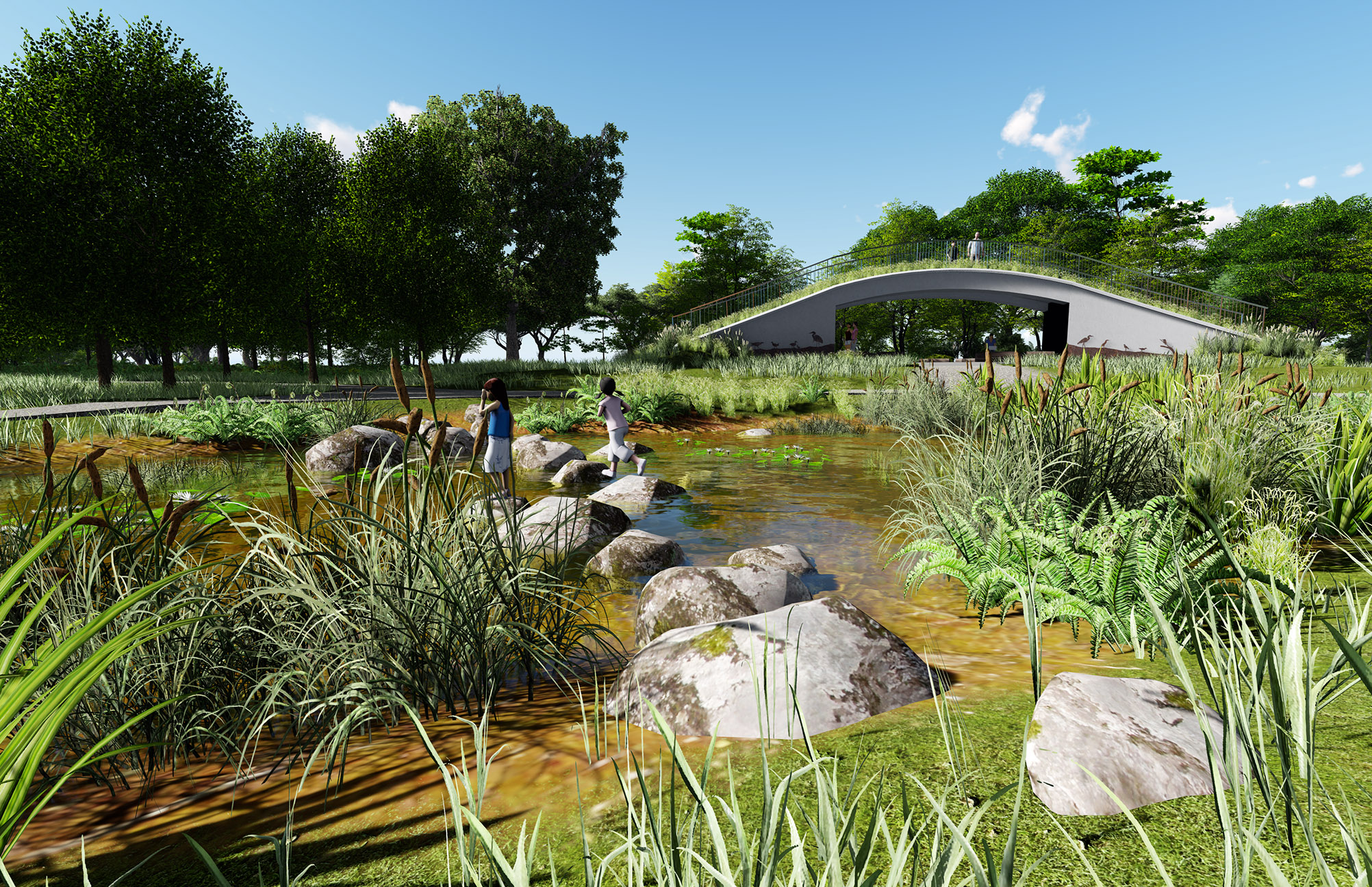
View across stepping stones towards the Kingfisher Burrow - Kranji Marshes

Kingfisher Burrow with green roof at Kranji Marshes
Moorhen Blind

Moorhen Blind at Kranji Marshes

Moorhen Blind at Kranji Marshes
Raptor Tower

View across pond to the Raptor Tower at the Marsh Station at Kranji Marshes

The Raptor Tower at the Marsh Station at Kranji Marshes
How do we produce the visualisations of our Landscape Architecture projects?
- First we build the 3D models of our structures, paths and landform in SketchUp.
- The SketchUp models need to be accurate and every material carefully assigned.
- The 3D model(s) are then imported into new Lumion scene either separately or as one file.
- Next we change or assign materials, and add objects and elements such as trees, people, vehicles, lights, and effects. All editing is rendered in real-time as you work.
- Once we have completed our Lumion scene we then move into photo mode where we add effects or styles before rendering the photo sets or into movie mode where we add movement, effects, styles, and produce the final animated movies.

We can even make it rain

....or even snow - though we have no need for this in Singapore !
Kranji Marshes- Singapore
Landscape Architects - Stephen Caffyn Landscape Design